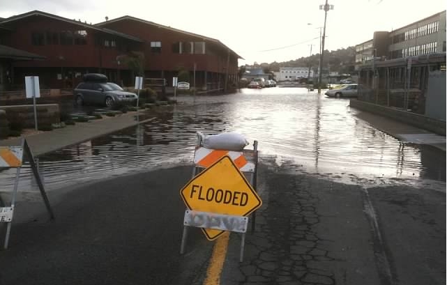
The alignment of the moon and the sun periodically brings especially high tides to Sausalito, and just in time for Wintefest the next round is coming this Friday-Monday, December 9-11, 2016. The forecast rain will make the water rise even higher, especially near the mouths of creeks and storm drains.
Our page with information and links for Sausalito flood zones and tide tables is here.
This combination often creates significant flooding along the Sausalito waterfront, especially along:
- Liberty Ship Way
- Marinship Way
- Gate 5 Road (shown in the photo above after a storm a few years ago, looking back from Gate 5 and Coloma towards Gate 5 and Harbor)
- Gate 6 Road
- Gate 6 1/2 Road
- The Manzanita Park and Ride just across the Mill Valley border. The CHP will block off parts of the lot prior to the first high tide of the cycle, but don’t park in the lowest-lying open spot because you could easily come back to a car in 2 feet of water.
The Mill Valley – Sausalito Multi-Use Path is also flooded when we have King Tides.
Parked cars have been totaled at Gate 6 1/2 road and Manzanita when water went as high as their hoods, because salt water can do irreversible damage with just one coating. Local officials often post signs in hazardous areas (and the Manzanita Lot is usually cordoned off for King Tides) but they can’t cover everywhere.
.
Insiders Tip: Driving through fresh water puddles that are not too deep does not hurt your car. But driving through the same depth of salt water puddle during or after a high tide gets salt and other nasties into the underside of your car, which can in particular attack your electronics system as well as triggering rust. I knew one woman whose BMW took over $3,000 to repair from the effects of one such encounter. Be careful out there!
In the Google Map below we used the Directions feature to show some of the areas most vulnerable to flooding, but there are other vulnerable places in town as well.
