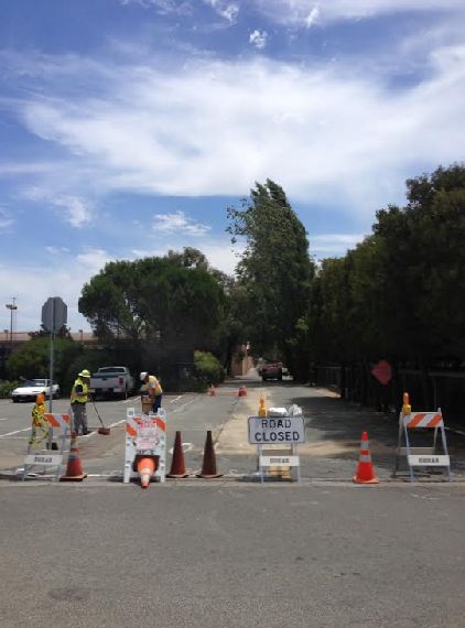
The US Army Corps of Engineers and the City of Sausalito have temporarily closed the stretch of Marinship Way between Testa Street and Liberty Ship Way in Sausalito (see map below) for the next several weeks for road repairs and restriping as they prepare for this year's Sausalito Art Festival.
Work began on July 14, and the Corps of Engineers is paying for the work since they own the land beneath the roadway there.
The launch of this project is a relief, since I was fanatically increasing the pressure in my tires to avoid having my car run aground on the "looks like a sidewalk but it's in the middle of the street" bump in the middle of Marinship Way next to the tennis courts of Marinship Park. These repairs will save me those twice-daily trips to the gas station.
The gas station that actually allows you to put air in your tires, I mean. As opposed to the one in Sausalito where the guy growls at you and refuses to help. But I digress.
Although the road will be closed to cars, you'll still be able to walk or ride your bike along the path that runs on the Bay side of the Bay Model between Liberty Ship Way and Testa St., from which you can access the north end of Marinship Way.
The Bay Model will remain open during construction.
There's no precise date listed for completion of the project, other than "in time for the Art Festival." This is because the area was created by hurriedly filling in San Francisco Bay marshlands in the early days of World War II. The construction happened so quickly and the area was abandoned so suddenly four years later that there are not great records of exactly what was buried where. The Corps is hoping to finish well before the Festival but left time in the schedule in case they find an old storage tank, more railroad lines, a kraken or other time-consuming artifact.
These bumps are described as being where tree roots are pushing up on the pavement and in one spot even raising the bed of some old railroad tracks, making the road treacherous for pedestrians, bike riders and cars. Scroll down for my alternate theory on what's going on.
I do wonder what will happen the next time that two double-parked Fed Ex trucks, three confused Mollie Stones vendors and four Marin Self Storage curbside parked trailers all convene on Marinship Way near Harbor Drive. The emergency-blinker brigade already blocks the road there several times a day, so the next few weeks will be interesting!
Information regarding the closure is available from: U.S. Army Corps of Engineers: 415-289-3007. City of Sausalito: Jonathon Goldman, Director of Public Works, City Engineer and ADA Coordinator, 415-289-4176 or jgoldman@ci.sausalito.ca.us.
Postscript: I know the story of the tree roots and the railroad tracks is probably true, but I prefer the version of the story where the uplifted blocks of pavement were from the escape attempts of the oversized sentient kraken kept in a massive secret tank below the Bay Model.
You see, the Bay Model is just a front to hide the secret subterranean government research facility where they work to learn the secrets of the kraken's great intellect, even as its powerful tentacles push up the pavement in rebellion. I mean, who buys the storiy of encasing acres of water with hundreds of pumps in a massive building just to study the Bay?! No, it's acres of water at ground level to cover up the acres of water below that hold the imprisoned kraken!
Google Map Instructions: Use the "+" and "-" buttons to zoom in and out, grab and pull to scroll the map, and click on the photo in the lower left to see the satellite view.
